Saturday, September 10, 2011

Heading Home

        Thursday, July 28th, was the day we had to leave for home. We had a wonderful time visiting with Pete and Amanda and they were great hosts!!  We hate to leave them, but we must. With heavy hearts, we packed the car and headed east.  Left Lane Joe is driving, Meredith is navigating, and Bessie is in the back with the kids.  It's a tight squeeze, but off we go!!  We drove and drove and drove for what seemed like hours and we are still in Oregon!!  These states out here are big.  At home we pass through three states to get to the closest Walmart.  It's a bit of a culture shock compared to back east.  After a very long day of driving through desolate country, we arrive in Boise, Idaho for the night. We saw one of the most desolate sights we saw anywhere on the entire trip.  We went by a lake in eastern Oregon called Lake Abert.  There is nothing around the lake, no vegetation, no homes, no stores, and no people.  It was a hot summer day and the lake was completely empty.  It was eerie.  I have never seen a body of water without something around it.  It turns out to be an alkali lake.  It is unsafe for humans and animals, and is fatal if water is swallowed.  What a shame, it really was pretty.  However, it seemed like it did have a purpose for the travelers on the Oregon trail.  They were running out of baking soda by the time they got to the lake.  Somehow they figured out they could used that alkali around the lake for baking soda.  If it was cooked it was safe.    This was just another interesting thing we learned about our country.  Everything seemed to have a purpose!!

Lake Abert


Boise is a very clean and pretty city.  We had a good night, including dinner at a truck stop.  When you eat at a truck stop. you can't help but getting a truck driver meal that's bound to be delicious.  We stuffed ourselves.
        Friday, July 29th - We headed across Idaho, bound for Idaho Falls.  We decided to get off the interstate, and onto a small road.  It turns out to be part of the Oregon Trail.  It was curvy and windy and climbed up high mountains, and wound down into deep valleys.  Bessie was holding on in the back seat for dear life.  It was impossible to imagine pioneers doing this road in covered wagons.  We encountered many RV's and that made the journey all the more exciting.  There were many places to look at along the way, including Craters of the Moon.  It was an area where there were volcanoes at one time.  There was a lot of big lava rock along the side of the road.  Again, it was hard to imagine how hard it was to drive a covered wagon over that rough terrain.  This portion of the Oregon Trail is near the end of the journey and many people were quite sick when they were here.  We were riding along and imagining how many people were buried alongside the road we traveled along.  We were thinking how fortunate we were to have reservations for the night in a motel with a pool and a hot tub.   We arrived in Idaho Falls in the afternoon in time for a relaxing swim and soak in the hot tub.  The rigors of the road are forgotten temporarily.  When we put things in perspective, the rigors of the road were absolutely nothing compared to what the pioneers went through.


Jeremiah at Craters of the Moon

Part of The Oregon Trail

More of Craters of the Moon

 One of the few places to get water on The Oregon Trail

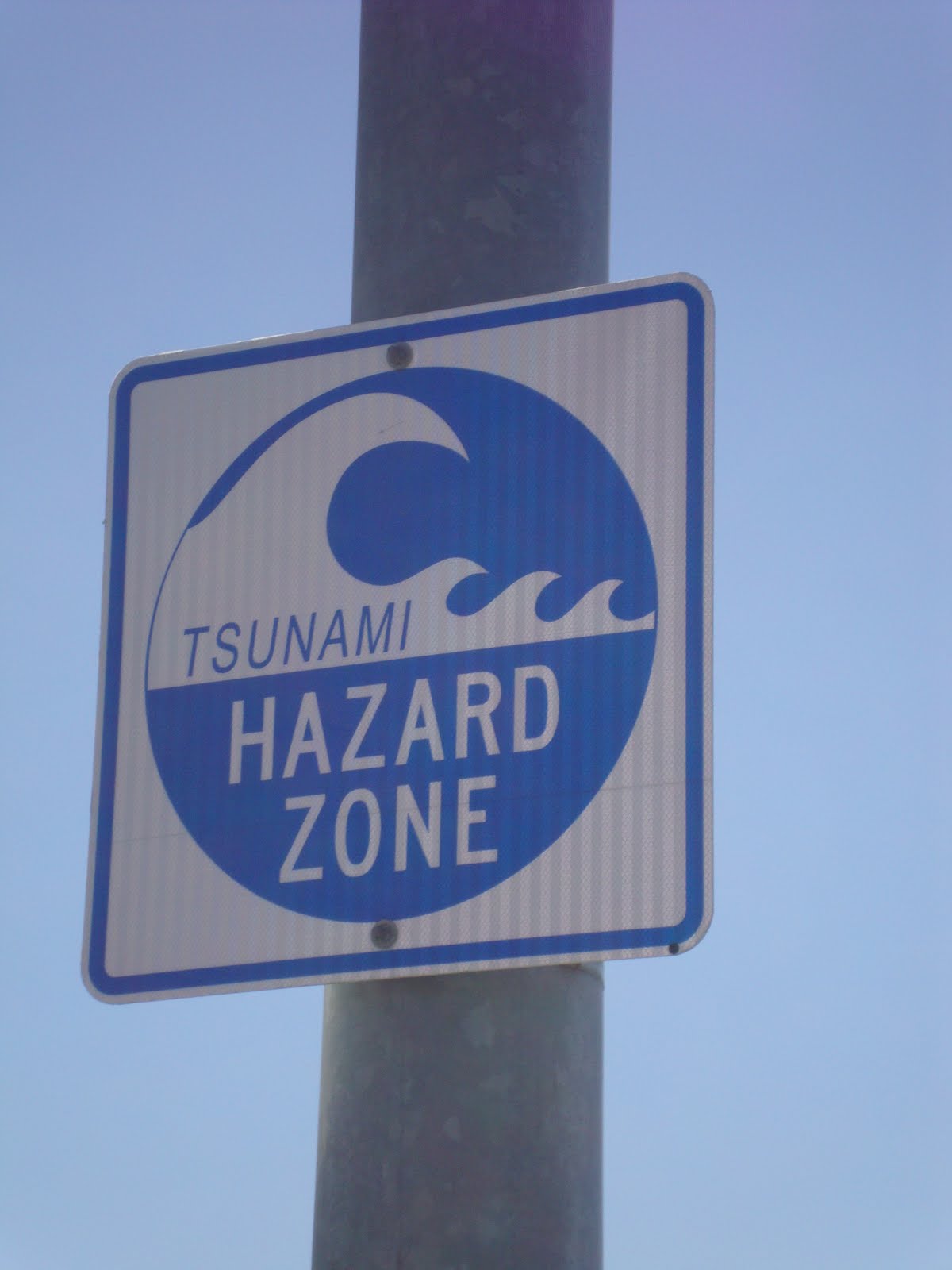
The Oregon Trail passes through southern Idaho.  The terrain is sometimes high desert and sometimes mountainous.  It goes over mountaintops and down into deep valleys.  There are twenty-one points  of interest along the way including Massacre Rocks state Park where Indian attacks were numerous.  Fort Hall Indian Reservation is where Sacajewea eventually settled.  Smith's Trading Post is the sight of Peg Leg Smith's trading Post.  It is said Peg Leg was quite a character who amputated his own leg when it was shot.  This trip across the Oregon Trail was pretty amazing, just imagining what it must have been like for the Pioneers.  I don't think we can even begin to imagine what they went through and how they suffered. 
        Saturday, July 30th - We are headed for The Grand Tetons and Yellowstone.  Bessie is very excited to finally be going to Yellowstone.  We drive to the entrance of Grand Teton National Park.  The park ranger asked if anyone in the car was 62 or over.  She probably took one look at the car and said that person in the back looks about 100!!  Bessie piped up that she was sixty-two.  So for ten dollars Bessie got a lifetime pass to all the national parks.  Anybody that's with her can get in free too.  That was pretty exciting!!  We drove through Grand Teton and it was beautiful beyond description.  Yellowstone also did not disappoint.  It was beautiful, however, it would have been good to see more wild life.  We saw one buffalo and one elk, but Yellowstone was interesting and fun.  We stayed in Powell, Wyoming for the night.  It was the most expensive and the worst hotel room of the trip.  It was close enough to Yellowstone, so the prices were high.

Grand Teton National Park was established in 1929.  Grand Teton is just south of Yellowstone.  The tallest mountain is 13,770 feet, and there are twelve others over 12,000 feet.  The peaks are made of crystalline rock and they are beautiful.  There are sixty species of mammals and more than 300 species of birds in Grand Teton.  There are around six kinds of game in the park.  You can hike, camp, climb, boat, and kayak.

The Grand Tetons


Yellowstone National Park is the nations first national park, and was established in 1872.  There are many interesting things to see in Yellowstone, such as hot springs and geysers.  Old Faithful is the most famous geyser, erupting regularly on schedule.  There are also mountain ranges and canyons, including the Grand Canyon of Yellowstone.  There is a large lake called Yellowstone Lake and many rivers and streams.  There is also an abundance of wild life including, herds of buffalo and elk, grizzly bears, wolves, and many others.  You can drive through  the park, stopping along the way.  Camping and hiking are popular, as well as lodges and cabins.


Old Faithful

Yellowstone Lake


Sunday July 31st - We headed over the Big Horn Mountains towards Deadwood, South Dakota.  These were the biggest and most treacherous mountains we crossed.  We kept telling Bessie to look out the window at the views, but she was quaking on the floor of the car.  After we climbed to the top on windy roads with no guardrails, we got to the top, where the speed limit was 65.  People were actually doing that and faster.  Again, so not like home!!  When we got to the bottom of the mountains, we are in desolate prairie.  We passed a few ranches, but they were few and far between.  Just very hard to imagine that people live that way!!  We arrive in Deadwood in time for a late lunch.  It's hot and noisy and threatening storms.  Bessie's a little anxious with all the commotion, so we ate and headed to Rapid City for the night.  The only place we could find to eat was Arby's, but that was okay since we had this huge lunch in Deadwood!!

View from the road through the Bighorn Mountains


 Jeremiah in Deadwood City, SD

Deadwood, South Dakota is an old western town located in Black Hills of South Dakota.  The goldrush of 1876 brought many visitors to town, including Wild Bill Hickok and Calamity Jane.  Wild Bill Hickok was shot in the back of the head and killed on August 2, 1876.  He wad playing poker at the number 10 saloon in Deadwood.  It's an old west town that's just plain fun!!
        Monday - July 1st - This is our last day of sightseeing and we are headed to Mount Rushmore.  It's beautiful and not what I expected.  It's nestled in some trees and the walkway leading up to it has a flag from every state.  It's corny, but it makes you proud to be an American!!  We finish at Mount Rushmore and we are headed east!!  We are on a mission.

Mount Rushmore National Memorial is located in Keystone, South Dakota.  It is a monument to four U.S. presidents who were major contributors to American history. You can the faces of George Washington, Thomas Jefferson, Abraham Lincoln, and Theodore Roosevelt.  They are carved in the southeast face of Mt.  Rushmore.  A sculptor named Gutzon Borglum had a vision about Mt. Rushmore, and began drilling into the stone mountain in 1927.  The mountain stands 5,725 feet high.  The faces are sixty feet high.  It took fourteen years and cost one million dollars.  It is truly amazing and breathtaking!!

Mt. Rushmore


We want to be home by Friday, August 5th.  Bessie psyches herself up for five days of left lane travel and passing every tractor trailer truck we can find.  Hopefully, we won't have to pass any triples!!  We spend the night in Nebraska.  Bessie is pleasantly surprised, but we stayed on a secondary road all day.  We drove through endless farm country.  There are some small towns, some with populations as small as thirteen.  (The population numbers are on the signs when you enter the towns.)  People are very isolated and it makes you hope everyone likes their neighbors, if they have any!!

        Tuesday - August 2nd - We spend the night in eastern Iowa.  We have seen a lot of flooded farmland due to the spring rains.

Sandbags to keep the road from flooding

 Some of the flooded farmland in Iowa

      Wednesday - August 3rd -We are in Van Wert, Ohio.  It's a very pretty little town, and they had the best restaurant, reminded us of 10 Bridge St.  They even had coconut cream pie.  It was free dessert night, so of course we indulged.
        Thursday - August 4th - We stayed somewhere on Interstate 80 in Pennsylvania.  We are arriving home tomorrow and we can't wait!!  The country is hilly again and beginning to look like home. 
        Friday - August 5th - We arrived home at about 2:00 in the afternoon.  We are tired, but thankful for such a wonderful trip.  8,000 miles and eighteen states later we are home after an incredible journey. This country is beautiful and amazing and around every corner there is a wonderful surprise!!

        Thanks to all who followed this journey.  I hope you enjoyed it.  Stay tuned, next year's trip is in the planning stages.  Nobody wants to talk about it yet, except for me, Bessie.  Maybe along about dreary December I will bring it up!!


Tuesday, July 26, 2011

Exploring Crater Lake

We are having a great time visiting Amanda and Pete and we're going to be very sad to leave them on Thursday!  Hopefully we will see them this fall.

On Sunday, Jeremiah and I went with Amanda to church.  It was really neat to see where they go to church.  Isaac was way too fussy that morning so Bessie stayed home with him. Bessie went to church last week, and really enjoyed Amanda and Pete's church!!

On Sunday afternoon we ventured up to Crater Lake.  It was a beautiful drive and there were a lot of people there.  All was going well until Bessie realized we were going to have to drive up the side of a mountain with a huge drop-off to get to the top.  I wasn't in the car with her but from what I understand she kept trying to get out of the car!  Dad refused to stop and let her out though!  Amanda had forgotten just how steep and windy the road was as well as the sheer drop-off the cliffs.  I had to admit, my heart was in my throat a couple of times.  Once we got up to the rim the drive around the rim was beautiful!  We were able to drive all the way around since they had just opened up the entire road in the last week or so.  I guess we went at the right time!  Jeremiah really wanted to go down into the lake but fortunately we were able to prevent that from happening!  Bessie was nervous during the drive but was very happy that she did it when all was said and done.

Crater Lake was formed after an ancient volcano collapsed.  The volcano erupted around 7,700 years ago and was forty-two times as strong as Mt. St. Helens in 1980.  The lake basin or crater was formed after the collapse of the crater.  The crater fills with around 4.6 trillion gallons of rainfall and snowmelt.  That is the only water that is in the lake.  It is the seventh deepest lake in the world at 1,932 feet.  There is a road through the mountains around Crater Lake called the Rim Road.  It is stunningly beautiful and scary and heartstopping all at the same time.  

Tonight we went to The Creamery here in Klamath Falls.  We were able to sit outside and it was beautiful!  Sitting outside is nice because we don't have to worry how much noise we make!


We are leaving on Thursday and we will miss our time here with Amanda and Pete.  I am really looking forward to going home though and I know James misses us terribly!  Please pray for safe travels!

Saturday, July 23, 2011

Crescent City Beach and Lake of the Woods

A couple of days ago we went to the beach.  Amanda, Bessie, the two kids, and me.  We had so much fun we decided to stay for two nights instead of one.  We stayed at the Curly Redwood Lodge, which was like a 1950s motor inn.  All of the wood in it was made from just one redwood tree.  The beach we went to was Crescent City Beach in Crescent City, CA.  This beach is right on the other side of the Redwoods.  Crescent City was one of the cities that was hit with a tsunami as a result of the earthquake that hit Japan back in March.  It should be noted here that Bessie woke up several times each night thinking she heard the tsunami sirens!  The fishing industry there was hit very hard and there was parts of the harbor that were destroyed.  We went to Ocean World and Jeremiah even pet a shark!


We also visited the Redwood Forest and saw the huge Redwood trees.  These trees were massive and I'll post some pictures.  


We went to one of the Redwood State Parks near Crescent City, California.  There is also a Redwood National Park, but we opted for the state park.  The redwoods date back about 240 million years.  They are Sierra Redwoods and are the largest trees in the world.  Most of the trees are between 250 and 300 feet tall.  The tallest is about 325 feet high.  The diameters can be thirty feet and the circumferences can be over ninety-four feet.  The forests are magical, very quiet, and  woodsy smelling.  It almost feels like a mythical place, as the trees are so tall, they don't seem real.  It's also eerily quiet.  It's truly an amazing place.


After we left Crescent City we made our way to Lake of the Woods where we had lunch.  There was a beautiful view of Mount Mclaughlin.  This post isn't filled with humor because we're tired today!  We only have 5 days left with Amanda and Pete and we will miss them!!!!!  Tomorrow we head to Crater Lake!

Monday, July 18, 2011

Lava beds, Decontamination, Revolution Church, Heart Stopping Roads!!

July 18, 2011

Hi All:

It's been a few days since we have blogged so we have some catching up to do!!  On Saturday, we went to Lava Beds National Monument in Tulelake, California.  The lava beds were formed by volcanic eruptions at the Medicine Lake Shield Volcano.  The landscape created by the volcanoes is very rugged and is dotted with cinder cones, lava flows, spatter cones, lava tube caves, and pit craters.  1872-1873 were the years the Modoc Indians took advantage of the lava flows during the war.  They were led by Captain Jack, and they sought refuge in Captain Jack's stronghold, which was a lava fortress.  From this stronghold, a group of fifty men and their families managed to hold off nearly 1,000 U.S. Army forces.  They were able to do that for about five months.  This land was very important culturally to the Modoc Indians, and was worth it for them to fight for it.  The battle was bloody for both sides, and the end result was typical of what happened to many Native American settlements.  The Modocs eventually were defeated.  That's the very short version of the story.

The day was fun for us, especially Meredith and Jeremiah.  They wanted to go in the caves, as did everyone but Bessie.  However, since they had both been in the Mark Twain Cave in Missouri, they had to be decontaminated before they could go in.  White Nose Disease, which has killed many bats across the United States, has not yet reached California, so anyone visiting the California caves has to be decontaminated if they've visited affected caves.

 Decontamination Complete!

Pete, Amanda, and Jeremiah in one of the Lava Bed Caves

Gary and Jeremiah picking up a lava rock

Amanda and Isaac enjoying the Lava Beds

 Lava Rock from Lava Beds National Monument

We stopped at a Dairy Bar in Merrill, Oregon on the way  back.  We passed up one of the local delicacies, Gizzards, in favor of creamies.  It was a fun day.

On Sunday, Amanda, Jeremiah, and I went to her church.  It's called Revolution Church, and it's a new church.  The pastor was powerful and on fire, and I enjoyed every second.  I'm so happy that she and Pete have found such a nice church home.

Today Amanda had to work and Pete was sleeping from being on call last night so we decided to go to Lake of the Woods.  It never rains in the high desert of southern Oregon, however it was pouring when we got there so we decided to drive over the mountains to Ashland for lunch.  When I say over the mountain, I mean that.  Elevation 4,500 feet, straight down, no guardrails, my heart was in my throat.  People actually live there, couldn't imagine it.  When I saw the sign for school bus stop, I really freaked!!  I think when I retire, I'll get a job driving a school bus on Route 66 in Oregon.

We are having a great time  It's supposed to rain tomorrow so we are not sure what we'll do, but Wednesday we are headed for the beach!!

We appreciate everyone's support and prayers for this incredible journey!!

Talk to you soon - Bessie

Wednesday, July 13, 2011

We Didn't Bust, We Made It!

 Pictures from I-70 in Utah


Train tunnel

Sign on US 50 a.k.a. "The Loneliest Road in America"

Our motel was a casino in Ely, Nevada but we didn't stay in the building where the casino was.

Still smiling on day 10!

Outside our motel.

One of the very few signs on US 50 in Nevada.

Thunder Mountain in California

There was much rejoicing when we saw the sign for Klamath Falls!!!

After a beautiful ride through Colorado and an equally pretty ride through Utah, we came to Nevada.  We traveled the Loneliest Road in America and I don't care if I ever do again.  It actually made me a little uneasy because there was almost no one else around.  At one point there was 120 miles between service stations!  I don't want to insult anybody but it wasn't my favorite state.

Route 50 is called the loneliest road in America.  In fact, we figured there are probably tee shirts that say: "I survived the loneliest road in America!"  However, there are no stores on the road, so nowhere to buy a tee shirt!!  The road stretches for about 350 miles.  It begins at the Utah-Nevada border and ends at the Nevada-California border.  It is an old Pony Express route.  The longest distance between services is about 120 miles, between Delta, Utah and Ely, Nevada.  We were fortunate to find a hotel room in Ely, complete with slot machines in the lobby.

We were surprised when we crossed the border into California.   There were what appeared to be toll booths, but they were actually inspection stations.  When you enter California, you have to declare any raw fruits and vegetables you had.  They don't want anything to contaminate their crops.  We declared the one apple that we had and they sent us on our way.  I'm sure they looked at the back seat, and saw this woman who by now looked old and haggard and two little kids, two adults in the front, and a back full of luggage and felt very sorry for us.  We are ready to be in Klamath Falls!!

Here we are looking out Amanda's window and we can see the snow-capped mountains that surround Crater Lake.  We are tired but we are here.  We are so happy to be able to spend 2 weeks with Amanda, Pete, and their dog Sam.  They have a beautiful house with a terrific view.  We also found a new great store, Fred Meyer!  I love it!!  I will post some pictures from our ride but beware it's all mountains of dirt and desert.  We are wondering why Nevada is called the Silver State and not the dirt state, if you know please tell me because there is an awful lot of dirt there as well as casinos (which are built on piles of dirt).